Tag Archives: Landscapes

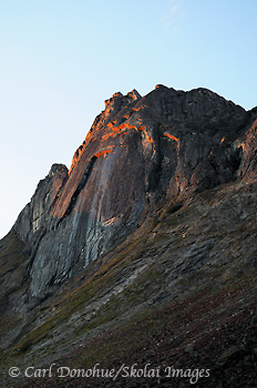
Arrigetch Peaks at first light

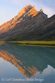
Arrigetch Peaks at dawn, Gates of the Arctic National Park, Alaska.

Arrigetch Peaks at dawn, Gates of the Arctic National Park, Alaska. Please click on the image above to view a larger version of this photo.

Hey Folks,

Here’s another photo from the trip to the Arrigetch Peaks we took back in August. This scene appealed to me, the light striking the underside of the crags’ overhang, yet most of the rock in shade. It was a wonderful morning, with some gorgeous early light that disappeared all too soon, the sun spent most of the day behind this ridge, but the view up and down the valley was simply stunning.

I hope to get back to this area sometime in the summer of 2012, and shoot it some more. Fantastic landscape. I think the fall is a great time to visit the arctic; earlier in summer the sun doesn’t get as low in the sky, which means the light doesn’t get quite as subtle as it does in the “shoulder seasons”, so we’ll probably head up there in August or September again some time. Look for a possible photo tour announcement coming this winter. I’ll keep you posted here for sure, but the trip will be run through Expeditions Alaska; awesome backcountry travel company! 🙂

Cheers

Carl
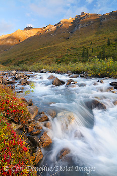
Fall colors in the Arrigetch Peaks

Arrigetch Creek, fall color, Gates of the Arctic National Park, Alaska.

Fall colors along Arrigetch Creek in Gates of the Arctic National Park, Sunrise over the Brooks Mountains, Alaska. Please click on the image above to view a larger version of this photo.

Hey Folks,

Here’s an image I took in August on a trip to the Arrigetch Peaks, in Alaska’s Gates of the Arctic National Park and Preserve. We’d had a great early morning hike up in to and around the Maidens Valley for sunrise, and I shot a few nice images of the peaks catching early light. Afterward we hiked back to camp to catch an hour or so of sleep before breakfast, but I took a few shots along the creek before my nap.

I really liked the warm light striking the top of this ridge above camp, but didn’t have long to find a complimentary foreground before the low-lying clouds blocked the light. A pretty good rule of thumb for any landscape photographer in the backcountry is to always camp by water; one can USUALLY find some kind of foreground with a water source, be it a pond, a stream, a lake, the ocean, a glacier, etc.

Here I added some color by setting up near this patch of bear berry, strikingly red in peak fall color. The whole process for this shot took maybe 5 minutes, from walking over to the stream and scratching around to find the composition I liked, checking exposure, etc, and shooting the frame. 10 minutes later I was in my sleeping bag, toasty warm, and the light had dropped from the ridge altogether. I was able to grab some sleep before getting up again for breakfast with the group to a cloudy and somewhat drab day. Continue reading

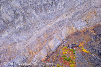
Erie Mine, Wrangell-St. Elias National Park, Alaska.

Erie Mine Bunkhouse, Wrangell-St. Elias National Park and Preserve, Alaska.

Erie Mine Bunkhouse and the Wrangell Mountains, fall colors. Erie Mine is one of three mines that made up the famous Kennecott Copper Mines, Kennicott, Wrangell-St. Elias National Park and Preserve, Alaska. Please click on the image above to view a larger version of this photo.

Hey Folks,

From the aerial shoot we did in September; this one is of the old bunkhouse at Erie Mine, one of the 3 Kennecott Mines, in Wrangell-St. Elias National Park.

It’s interesting to me how much money, time and investment the National Park Service put into Kennecott, an old abandoned Copper Mine. The basic tenant of the Park Service is “don’t take stuff out of the place, and don’t leave your trash behind”.

It seems odd to effectively celebrate an organization that did quite the opposite of that. The mining company, like most mining companies, took what they wanted from the landscape, and left all their sh** behind when they were done. Now, what they did is revered.

But, such are the ways of the NPS; sometimes they’re hard to follow.

Cheers

Carl

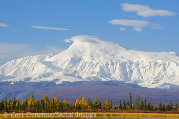
Mt. Sanford

Mount Sanford, Wrangell-St. Elias National Park and Preserve, Alaska.

Mount Sanford, early morning, fall colors and a kettle pond, boreal forest, Wrangell-St. Elias National Park and Preserve, Alaska. Please click the image above to view a larger version of this photo.

Hey Folks,

So while I’m off in Katmai photographing the bears, I’ll schedule a post or 2 from the summer. Here’s a shot of Mt. Sanford not long after sunrise one gorgeous sunny fall morning. What a view!

Cheers

Carl

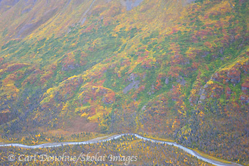
Fall colors in Wrangell-St. Elias National Park

Fall colors, Wrangell-St. Elias National Park and Preserve, Alaska.

Fall colors in Wrangell-St. Elias National Park and Preserve, Alaska. Aerial photo. Please click on the image above to view a larger version of this photo.

Hey Folks,

Here’s a quick shot from a flight we took over the park last week; the weather wasn’t so awesome, but the flight sure was. I’d shot this valley before, and knew it would have some nice color.

Now, back to packing gear for the grizzly bear photo tour.

Cheers

Carl

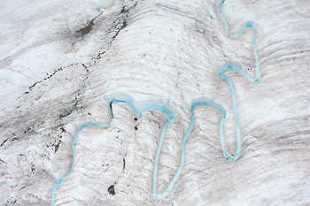
Glacial Stream, Root Glacier, Wrangell-St. Elias National Park

Glacial Stream, Root Glacier, Wrangell-St. Elias National Park and Preserve, Alaska.

Glacial Stream and ogives, Root Glacier, Wrangell-St. Elias National Park and Preserve, Alaska. Please click on the image above to view a larger version of this photo.

Hey Folks,

From my most recent trip to Wrangell-St. Elias National Park and beyond. This is an aerial photo from above the Root Glacier, near Kennecott and McCarthy, Wrangell-St. Elias National Park and Preserve. The small stream is made up largely of runoff water from Stairway Icefall, a massive 7000′ vertical wall of ice that effectively form the “headwaters” of the Root Glacier.

This is an image I’ve wanted to capture for sometime now; I’ve seen various similar images of this same stream from a few photographers, including my friend Ron Niebrugge, and often thought it would be a cool subject to shoot. Indeed it is.  Continue reading

Xanadu, Arrigetch Peaks, Gates of the Arctic National Park

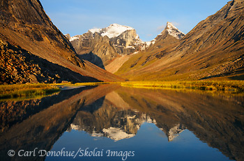
Arrigetch Creek, the Arrigetch Peaks, Gates of the Arctic National Park and Preserve, Alaska.

Arrigetch Creek and reflection of the Arrigetch Peaks, Albatross, Xanadu, and Ariel. Early morning light, just after sunrise, fall, Gates of the Arctic National Park and Preserve, Alaska. Please click on the image above to view a larger version of this photo.

Hey Folks,

Here’s another from the Arrigetch Peaks trip we did last month, August. This was our first morning up in the valley; really a treat to wake up to something like this. Of course, waking up at 4:30am isn’t such a treat, but such is the life of photography in the Arctic summer.

The 3 peaks in this frame are Xanadu, the largest in the background, with Albatross in front of it, and Ariel on the right hand side of the frame. Going out of the frame to the right is Caliban.

A mile or so up the creek from here we saw a, wait for it .. a beaver. That was pretty wild, I never thought they’d be up in rock climbing territory. Animals are just full of surprises.

Cheers

Carl

Iceberg Lake photo, Wrangell-St. Elias National Park

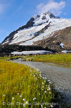
Alaska Cotton, and glacier, Wrangell-St. Elias National Park and Preserve, Alaska.

Alaska Cotton, and glacier, near Iceberg Lake, Wrangell-St. Elias National Park and Preserve, Alaska. Please click on the image above to view a larger version of this photo.

Hey Folks,

We just got off a great hike in the Chugach Mountain Range, Wrangell-St. Elias National Park; the Iceberg Lake to Bremner Mines route, a popular hike I’ve done a number of times now. This trip was an exciting adventure, as always, with a mixture of weather, some great folks to hike with, tons of cool stuff to see.

We actually took what is for me a new route part of the way, and skipped one of the climbs; heading straight for a glacier moraine and on to the ice instead. That was kinda cool, and I did find a great spot to camp that I hadn’t been to before, which is always a treat.

This image is from the first morning of the trip, when the skies cleared and we had some nice morning light. The day before it had been drizzly and overcast, and we hiked along the now empty lakebed of Iceberg Lake; it drains every summer.

After a hearty breakfast and packing up camp we headed off across a glacier and up higher to another campsite, where we did a short dayhike down to a few small alpine lakes. Great day indeed. The weather changed a lot during the 8 days of our trip, and we were constantly layering clothes on and off. The wind was cold, even on the sunniest of days, and fall is most definitely here in Alaska.Fresh snow on the peaks around us, the locals calls “Termination Dust” (i.e., the termination of summer) greeted us a number of mornings.

We made it to our pickup at Bremner Mines on time, and then had to wait for a break in the weather before our pilots came and got us, ferrying us quickly back to McCarthy, hot food, showers, chairs with backs, and all the comforts of the a small town. Good times.

Great trip, all in all.

Cheers

Carl

Caliban, Arrigetch Peaks, Gates of the Arctic

Caliban, Arrigetch Peaks, Gates of the Arctic National Park, Alaska.

Caliban, Arrigetch Peaks, Gates of the Arctic National Park, Alaska. Please click on the image above to view a larger version of this photo.

Hey Folks,

Here’s a quick shot of Caliban, from the Arrigetch Peaks. Interestingly, I shot this image just minutes after I dropped my 18-70mm lens into a small pond and totally destroyed it; the lens still have grit and glacial silt inside it from the Arrigetch Peaks; I know the NPS have a rule about “take only pictures”, but I figured if my lens was busted, and I couldn’t really take pictures any more, it might be OK to take some glacial silt with me.

Gates of the Arctic National Park hiking trips.

Cheers

Carl

Down Arrigetch Creek

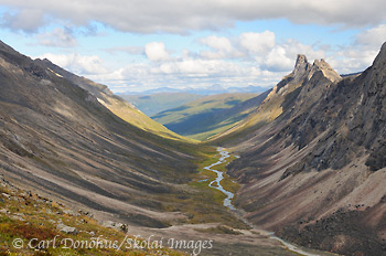
Arrigetch Creek, Arrigetch Peaks, Gates of the Arctic National Park and Preserve, Alaska.

View down Arrigetch Creek, from near Escape Pass, and the peak called Albatross. Elephant’s Tooth visible in the distance. Arrigetch Peaks, Gates of the Arctic National Park and Preserve, Alaska. Please click on the image above to view a larger version of this photo.

Hey Folks,

So here’s the view from my previous blog post in reverse; that shot looks up the valley towards where this one was taken. The peak at the far end of the valley, on the right hand side, is known as Elephant’s Tooth, a classic granite outcrop in the Arrigetch Peaks. The creek here is Arrigetch Creek (I’m not sure, but the word “Arrigetch” may well be a traditional Native Alaskan word meaning “rains like a sonuvagun” or something similar)

We hiked up this valley, climbed up high and had supper on a small plateau above the valley. A really great spot to camp. The next morning we ate breakfast and packed up, heading higher still to cross thru a high narrow pass towards another drainage, but we were thwarted by a nasty storm and precipitous granite; in the stormy weather I had neither the time nor inclination to scrap around and find a safe route across the steep traverse on the other side, and we descended to the valley floor after lunch.

Sometimes safety means turning back. But what a place to turn back toward, eh?

Cheers

Carl